Ad

Ad

Progress for group 0 ad

Daniel Metaferiya
Addis Ababa, Ethiopia
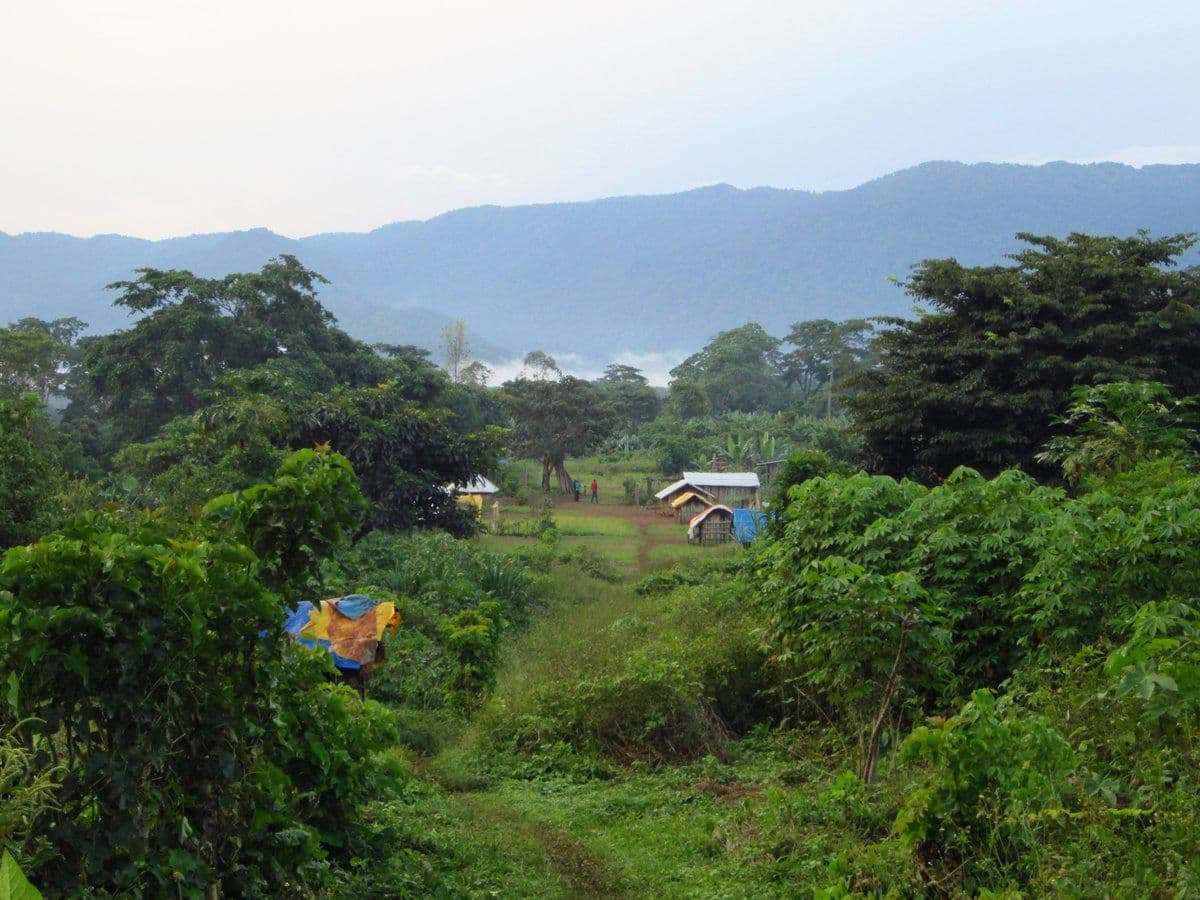
The Ethiopian Space Science & Geospatial Institute has initiated a project to digitally register forests in the South West Region. Commencing with the Kefa Sheka forest, recognized as a UNESCO-reserved biosphere area in Ethiopia, the project aims to employ advanced technologies to map and monitor these critical ecosystems.


Berhan Gessesse, Senior Researcher, and head of the Remote Sensing Department told Shega that the digital registry would streamline data access for research purposes, especially considering the forest’s susceptibility to the adverse effects of rapid population growth.
Spanning 238,750 hectares, the Kefa Sheka Forest encompasses a distinctive biogeographic unit that ranges from cold and extremely wet highlands to hot lowland areas. Its diverse vegetation includes over 300 higher plants, with at least 55 being endemic to the area.


Utilizing a combination of high-resolution satellite imagery and on-the-ground manual data collection, the Institute aims to create a comprehensive map accessible to anyone with internet connectivity.
“The map will display historical, current and future predictions of forest conditions. We will be digitally recording all elements within the forest to enhance resource management,” he told Shega.
“The urgency of the initiative is underlined by the current impact of population growth on the ecosystem, leading to deforestation as people seek areas for habitation,” he added.
The senior researcher states that deforestation poses a significant threat to the region’s biodiversity, and the digitalized forest registry is envisioned as a vital tool for preserving its health and condition.
The head of the Southwest Region Forest Environment Protection & Climate Change Bureau, Asrat Gebremariam (PhD), emphasized that the regional government has given special attention to bringing the project to fruition.
He also highlighted that the project’s effectiveness relies on knowledge, underscoring the need to mobilize adequate human resources from all zones to gather information.
Data from World Bank shows that in 2021 Ethiopia had15.6% of its territory covered by forests, equivalent to 12,296,000 hectares of wooded land.
Furthermore, the nation is actively engaged in annual tree planting initiatives through the Prime Minister’s Green Legacy Initiative. Since 2019, the govermenent states that the country has planted over 25 billion trees.
Formed in 2022, The Ethiopian Space Science & Geospatial Institute supports the nation’s digitization efforts. The Institute is currently developing a Digital Addressing System (DAS) that will enable door-to-door services in Bishoftu City for 73 large and medium-sized cities in the country.
Share this post:

Daniel Metaferiya
Jane Doe is an accomplished writer and storyteller with a passion for exploring the intricacies of human relationships. She holds a Master’s degree in Creative Writing from the University of Fiction and has published several novels and short stories in various literary magazines. When she's not writing, Jane enjoys hiking in the mountains, experimenting with new recipes in her kitchen, and volunteering at her local animal shelter. Her work often reflects her love for nature and her commitment to social issues. Jane lives in Seattle with her two rescue dogs, Max and Bella. You can find her online at www.janedoeauthor.com and on social media @JaneDoeWrites.
At Shega, we do more than tell stories. We help you make an impact. Our platforms, data, and expertise connect brands, organizations, and investors to the audiences and insights that matter.
Reach, engage, and grow with us.
Get in Touch
Insights into the Personal Data Protection Proclamation
02 September 2024

Yango Hits 1 Million Users in Ethiopia test
31 August 2024

Ethiopia’s Delicate Dance with Personal Data Protection
24 August 2024
Latest Stories
25 February 2026
𝗖𝘂𝗽𝗶𝗱’𝘀 𝗖𝘂𝗿𝗿𝗲𝗻𝗰𝘆: 𝗚𝗹𝗼𝗯𝗮𝗹 𝗧𝗿𝗮𝗱𝗲 𝗦𝗵𝗮𝗽𝗲𝘀 𝗔𝗱𝗱𝗶𝘀 𝗔𝗯𝗮𝗯𝗮’𝘀 𝗩𝗮𝗹𝗲𝗻𝘁𝗶𝗻𝗲’𝘀 𝗗𝗮𝘆 𝗥𝗼𝘀𝗲𝘀
By Bethel TesfayeLatest Stories
𝗖𝘂𝗽𝗶𝗱’𝘀 𝗖𝘂𝗿𝗿𝗲𝗻𝗰𝘆: 𝗚𝗹𝗼𝗯𝗮𝗹 𝗧𝗿𝗮𝗱𝗲 𝗦𝗵𝗮𝗽𝗲𝘀 𝗔𝗱𝗱𝗶𝘀 𝗔𝗯𝗮𝗯𝗮’𝘀 𝗩𝗮𝗹𝗲𝗻𝘁𝗶𝗻𝗲’𝘀 𝗗𝗮𝘆 𝗥𝗼𝘀𝗲𝘀
25 February 2026


Insights into the Personal Data Protection Proclamation
02 September 2024
Yango Hits 1 Million Users in Ethiopia test
31 August 2024
Ethiopia’s Delicate Dance with Personal Data Protection
24 August 2024